Data Processing Information
Data Controller: Alberto Mármol Báez
Purpose: Management, analysis, and response to inquiries. If you provide explicit consent by checking the box, we may also send you commercial communications about our products and services.
Legal basis: Your consent provided here.
Your data will not be shared with third parties unless legally required.
You confirm that you are over 14 years old and legally capable of providing this consent, in accordance with our Privacy Policy.
You may access, rectify, or delete your data, as well as exercise other rights explained in the additional information.
See our full privacy policy for more details.
Surveying GPS: Precision and Technology for Field Measurement
In surveying, precision is the foundation of any successful survey. Technological evolution has led to the development of advanced tools, and among them, surveying GPS units have become essential for professionals in the field.
At GNSS Estudio, we understand the importance of reliable, accurate equipment. That’s why we are official distributors of Precise, a leading brand in satellite positioning technology. One of their flagship products, the RTK GPS Precise-X, offers centimeter accuracy, advanced connectivity, and ease of use in any terrain.
What Is a Surveying GPS?
A surveying GPS is a device that uses satellite signals to calculate the precise location of a point on the Earth’s surface. Unlike conventional GPS, those designed for surveying operate with GNSS technology, allowing them to receive signals from multiple satellite constellations (GPS, GLONASS, Galileo, BeiDou).
These devices are essential for applications such as:
✅ Surveying for construction and urban planning
✅ Geodesy and cartography for accurate mapping
✅ Land measurement and boundary demarcation
✅ Civil engineering and structure layout
RTK GPS units are the most advanced in this category, offering centimeter-level accuracy in real time by eliminating errors caused by the ionosphere and other environmental factors.
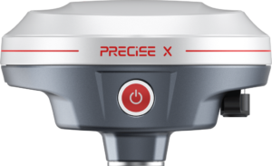
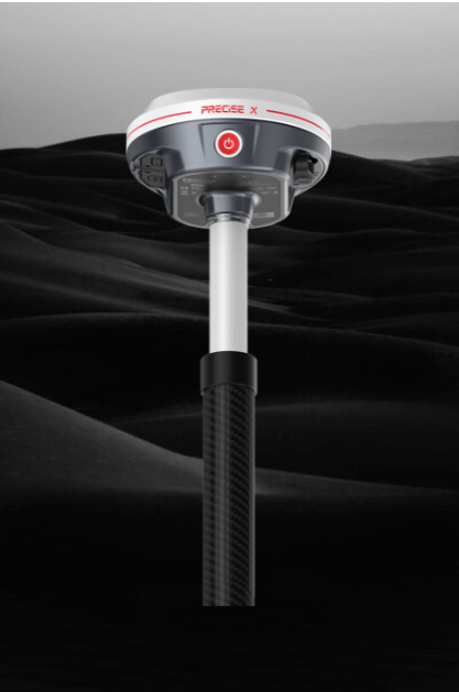
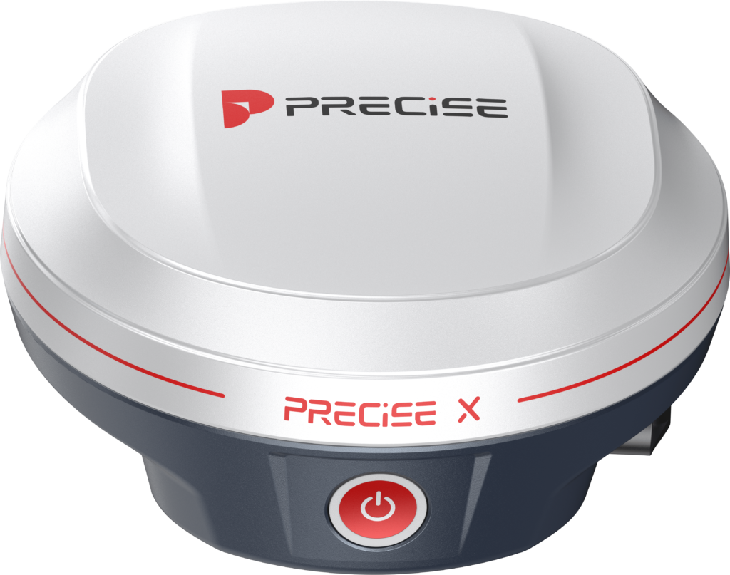
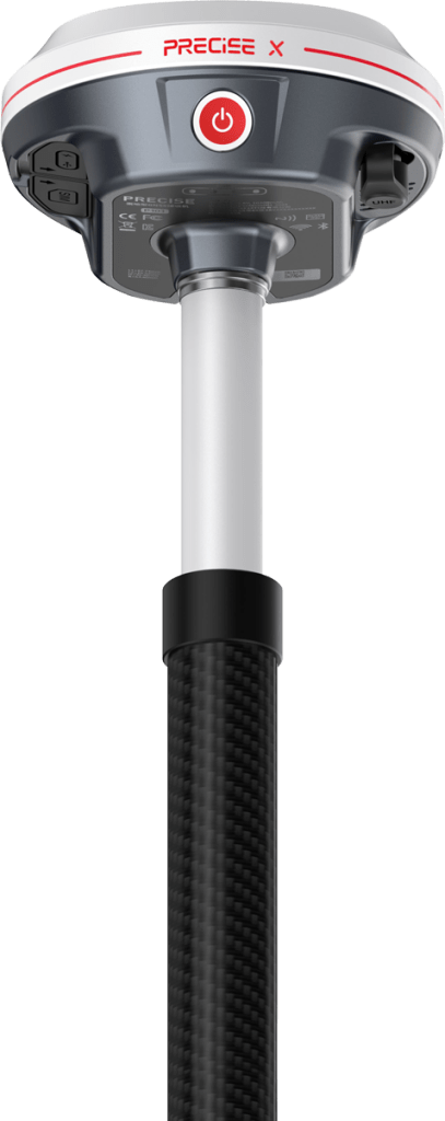
RTK GPS Precise-X: Precision and Connectivity in the Field
Precise-X is a high-precision RTK GPS designed to deliver exact results in any environment. With multi-constellation reception and advanced processing, it provides real-time centimeter positioning, optimizing surveying work with speed and reliability.
Key Features of Precise-X
✔️ Centimeter-level accuracy with RTK technology
✔️ Multi-constellation support: GPS, GLONASS, Galileo, BeiDou
✔️ Real-time corrections reduce measurement errors
✔️ Long battery life for extended fieldwork
✔️ Rugged, water and dust-resistant design (IP67 certified)
✔️ Advanced connectivity: Compatible with NTRIP networks and base stations
Precise-X is the perfect solution for professionals seeking fast, precise, and reliable measurements in any location.
Benefits of Using an RTK Surveying GPS
Investing in equipment like Precise-X provides numerous benefits:
🔹 Greater data accuracy, reducing measurement errors
🔹 Time and resource savings by eliminating repetitive manual measurements
🔹 Efficient data collection for faster plan and map generation
🔹 Adaptability to urban or rural environments
🔹 Easy-to-use interface with real-time connectivity
RTK GPS systems like Precise-X have revolutionized surveying, delivering high-precision results faster and more efficiently.
How to Choose a Surveying GPS?
If you’re looking for a surveying GPS, consider these key aspects:
✅ Precision and GNSS compatibility – More satellite systems mean better accuracy
✅ Real-time corrections (RTK) – Ensure exact measurements without manual adjustments
✅ Battery life and durability – Essential for fieldwork
✅ Connectivity and compatibility – Must work with base stations or NTRIP networks
✅ Ease of use – A simple interface boosts efficiency
Precise-X meets all these requirements, making it one of the best choices on the market for surveying and civil engineering professionals.
Frequently Asked Questions about Surveying GPS
Can Precise-X be used in any country?
Yes, it supports major satellite constellations (GPS, GLONASS, Galileo, BeiDou), so it works worldwide.
Do I need a base station to use Precise-X?
Not necessarily. It can work with a base station or connect to an NTRIP network for real-time RTK corrections.
Does Precise-X work in areas with poor satellite signal?
Thanks to multi-constellation support, it can operate in low-signal areas and still maintain high precision.
How long does the Precise-X battery last?
It has a long-lasting battery ideal for full workdays in the field without interruptions.
Need Advice on the Precise-X GPS?
At GNSS Estudio, we specialize in surveying solutions and provide technical guidance to help you choose the right equipment. If you have questions about Precise-X, contact us and we’ll respond within 24 business hours.
Trust GNSS Estudio and take your field precision to the next level with the Precise-X RTK GPS!
")